Busy lunch as we prep for Hurricane Irma hit. Can you say sandbags?

Disaster response = fun times.

Busy lunch as we prep for Hurricane Irma hit. Can you say sandbags?
Disaster response = fun times.
HQ, I copy the demob orders from Texas and Puerto Rico.
I also copy the new deployment orders for Florida.

Less than 24-hours.
FEMA Administrator Brock Long made a poignant statement about his employees today in the NY Times:
“…this is what we train for” – FEMA Administrator Brock Long

Brock Long, center, at a briefing on Hurricane Harvey relief efforts with President Trump and local organizations in Corpus Christi, Tex., last week. Credit Doug Mills/The New York Times
Yes sir, we train all the time.

Many instructors across this nation can attest the long hours we spend providing training for hundreds of thousands of our all-hazards public safety professionals from all walks of life.
This is truly what we train for.
I have a weird feeling that it’s going to be Florida.

Things are spinning up and quite honestly, Hurricane Irma looks pretty fugly.
Welp, Saturday plans will have to look slightly different now.

Better mount up as I *think this is for Texas.

Well, I don’t *think I’m going to need my tie, but definitely my best pair of boots.
Incident Management: External Affairs Media Relations Spc…aka PIO!
Along with #Harvey – I spy with my right eye, #Hurricane #Irma
TBT to a Category 4 Hurricane Kevin from 1991.

Whoa-Hurricane Kevin was quite strong.
Saffir-Simpson Hurricane Wind Scale: The Saffir-Simpson Hurricane Wind Scale is a 1 to 5 rating based on a hurricane’s sustained wind speed. This scale estimates potential property damage. Hurricanes reaching Category 3 and higher are considered major hurricanes because of their potential for significant loss of life and damage. Category 1 and 2 storms are still dangerous, however, and require preventative measures. In the western North Pacific, the term “super typhoon” is used for tropical cyclones with sustained winds exceeding 150 mph.
| Category | Sustained Winds | Types of Damage Due to Hurricane Winds |
|---|---|---|
| 1 | 74-95 mph 64-82 kt 119-153 km/h |
Very dangerous winds will produce some damage: Well-constructed frame homes could have damage to roof, shingles, vinyl siding and gutters. Large branches of trees will snap and shallowly rooted trees may be toppled. Extensive damage to power lines and poles likely will result in power outages that could last a few to several days. |
| 2 | 96-110 mph 83-95 kt 154-177 km/h |
Extremely dangerous winds will cause extensive damage: Well-constructed frame homes could sustain major roof and siding damage. Many shallowly rooted trees will be snapped or uprooted and block numerous roads. Near-total power loss is expected with outages that could last from several days to weeks. |
| 3 (major) |
111-129 mph 96-112 kt 178-208 km/h |
Devastating damage will occur: Well-built framed homes may incur major damage or removal of roof decking and gable ends. Many trees will be snapped or uprooted, blocking numerous roads. Electricity and water will be unavailable for several days to weeks after the storm passes. |
| 4 (major) |
130-156 mph 113-136 kt 209-251 km/h |
Catastrophic damage will occur: Well-built framed homes can sustain severe damage with loss of most of the roof structure and/or some exterior walls. Most trees will be snapped or uprooted and power poles downed. Fallen trees and power poles will isolate residential areas. Power outages will last weeks to possibly months. Most of the area will be uninhabitable for weeks or months. |
| 5 (major) |
157 mph or higher 137 kt or higher 252 km/h or higher |
Catastrophic damage will occur: A high percentage of framed homes will be destroyed, with total roof failure and wall collapse. Fallen trees and power poles will isolate residential areas. Power outages will last for weeks to possibly months. Most of the area will be uninhabitable for weeks or months |
Don’t wait. Communicate. Make your emergency plan today.

Hurricanes are unpredictable so get Ready by starting here for free!
| 14-006: Technical jargon and giving actionable information | |
| Agency: Chicago Fire Department | Topic(s): Industry codes / Actionable info |
| Date: Fall 2014 | Platform: Twitter |
Industry speak or technical jargon is part of what we do every day. But using technical terms on a social media platform will be confusing to those who are NOT in the fire service. That’s what the Chicago Fire Department did yesterday at their big 3-alarm fire when they tweeted technical jargon.


The use of technical jargon is rampant in emergency services but when speaking to the media or the general public, we need to remember that everyone did not grow up with a VOX alarm or SCU tones. In this case, a “311” or 3-11 alarm means that there are 11 engines, 5 Trucks, 2 Tower Ladders, 6 Battalion Chiefs, 1 Rescue Squad, 2 Ambulances, 2 Paramedic Chiefs, Deputy District Chief, Deputy Fire Commissioner, and the 1st Deputy Fire Commissioner are onscene. There is no way to include all that information in a tweet, but using more simple terms will help your audience understand the scale of your ongoing incident.
Before you post images, make sure your pictures are rotated correctly. I know accuracy is sometimes overlooked in lieu of speed, but it takes less than 5 seconds to orientate/rotate a picture (In this case, it was going to be a long operation). And note, by just rotating a picture does not equate that you are “doctoring up” photos. But a correctly posted photo will help media repost and format your information quicker to the masses.
During an emergency situation, your constituents need the information pushes to be actionable and specific to your audience. Not only inform them of the danger, but tell them what they can do about it.
A more effective tweet could have read:
| Chicago Fire: Large 3-alarm fire at Harrison St x Fifth Ave. Traffic delays-avoid the area. (insert two pictures) |
By phrasing it this way:
Time is valuable, so tweet good stuff.
***To download this as a single-page printable format, click this file:
TechnicalJargonAndGivingActionableInformation-Safety-PIO-SM-14-006
SitRep for West Virginia Chemical Spill (EM-3366) – 01-14-14- at 1030.
The chemical spill (up to 7,500 gallons) into the Elk River in Charleston, Kanawha County, West Virginia continues to dissipate. “Do not use water” order remains in effect for approximately 65,000. Chemical identified as 4-methycyclohexane methanol (MCHM).

http://www.amwater.com/about-us/news.html
FEMA continues to support the state and local partners in assisting in the mitigation efforts to these nine communities.
@rusnivek
SitRep for West Virginia Chemical Spill (EM-3366) – 01-13-14- at 0900.
The chemical spill into the Elk River in Charleston, Kanawha County, West Virginia continues to dissipate.
CDC has established threshold levels. At this time, indicators are within acceptable levels at water plant. Now seeking consistent safe reading levels at various points within the 1,700 mile pipeline system. Chemical identified as 4-methycyclohexane methanol.
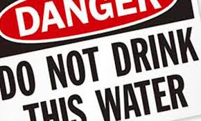
Counties affected: Boone County, Cabell County, Clay County, Jackson County, Kanawha County, Lincoln County, Logan County, Putnam County, and Roane County.
People in the affected areas in West Virginia = DO NOT DRINK OR USE THE WATER. *Only use for toilet flushing
FEMA continues to support the state and local partners in assisting in the mitigation efforts to these nine communities.
@rusnivek


