Awwww, thank you for the kind words! From the pros at the National Weather Service Office in Louisville.

*blush*
Wx love from the Louisville crew definitely made my day.

Awwww, thank you for the kind words! From the pros at the National Weather Service Office in Louisville.
*blush*
Wx love from the Louisville crew definitely made my day.
Ahhhhh, the last day of 2015 National Preparedness Month – THAT MEANS TODAY IS NATIONAL PREPAREDNESS DAY!!!!

Oh Yeah – You did it!
I know many of you have shared your tips and preparedness efforts with countless others. I am confident that your shared knowledge will pay off as we better prepare our fellow Americans for any disaster or emergency.
Thanks to all of our active partners in public safety. From the Locals to State to Federal partners who have made this month so successful – thank you!
Thank you to my agencies who have allowed me to share my preparedness tips with you.
I only wonder what will 2016 preparedness bring? Hmmm. Here’s a hint…
…and a little of this…

…and definitely more of this.

Who’s excited? <SQUIRREL!>
Don’t wait. Communicate. Make your emergency plan today.

Whew-I am so glad that many of you have decided to participate in this month’s activities. Keep in mind that you have 11 more months to address your public in finding ways to be better prepared in a disaster. Planning for the 2016 National Preparedness Month will begin shortly.
As always, start your peeps off right by sending them here.
TBT to a Category 4 Hurricane Kevin from 1991.

Whoa-Hurricane Kevin was quite strong.
Saffir-Simpson Hurricane Wind Scale: The Saffir-Simpson Hurricane Wind Scale is a 1 to 5 rating based on a hurricane’s sustained wind speed. This scale estimates potential property damage. Hurricanes reaching Category 3 and higher are considered major hurricanes because of their potential for significant loss of life and damage. Category 1 and 2 storms are still dangerous, however, and require preventative measures. In the western North Pacific, the term “super typhoon” is used for tropical cyclones with sustained winds exceeding 150 mph.
| Category | Sustained Winds | Types of Damage Due to Hurricane Winds |
|---|---|---|
| 1 | 74-95 mph 64-82 kt 119-153 km/h |
Very dangerous winds will produce some damage: Well-constructed frame homes could have damage to roof, shingles, vinyl siding and gutters. Large branches of trees will snap and shallowly rooted trees may be toppled. Extensive damage to power lines and poles likely will result in power outages that could last a few to several days. |
| 2 | 96-110 mph 83-95 kt 154-177 km/h |
Extremely dangerous winds will cause extensive damage: Well-constructed frame homes could sustain major roof and siding damage. Many shallowly rooted trees will be snapped or uprooted and block numerous roads. Near-total power loss is expected with outages that could last from several days to weeks. |
| 3 (major) |
111-129 mph 96-112 kt 178-208 km/h |
Devastating damage will occur: Well-built framed homes may incur major damage or removal of roof decking and gable ends. Many trees will be snapped or uprooted, blocking numerous roads. Electricity and water will be unavailable for several days to weeks after the storm passes. |
| 4 (major) |
130-156 mph 113-136 kt 209-251 km/h |
Catastrophic damage will occur: Well-built framed homes can sustain severe damage with loss of most of the roof structure and/or some exterior walls. Most trees will be snapped or uprooted and power poles downed. Fallen trees and power poles will isolate residential areas. Power outages will last weeks to possibly months. Most of the area will be uninhabitable for weeks or months. |
| 5 (major) |
157 mph or higher 137 kt or higher 252 km/h or higher |
Catastrophic damage will occur: A high percentage of framed homes will be destroyed, with total roof failure and wall collapse. Fallen trees and power poles will isolate residential areas. Power outages will last for weeks to possibly months. Most of the area will be uninhabitable for weeks or months |
Don’t wait. Communicate. Make your emergency plan today.
Hurricanes are unpredictable so get Ready by starting here for free!
For hurricanes, do you know the difference between Watch vs Warning?

and
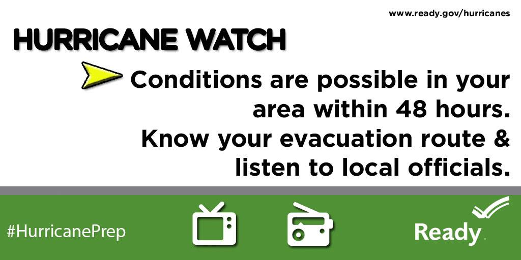
Simple huh?
For more information, check out FEMA’s Ready.Gov program.
And be prepared for the next hurricane!
Don’t wait. Communicate. Make your emergency plan today.
Awwww yeah, I’m talking about hurricanes on a Windsday.
10 years ago, Hurricane Katrina ravaged the gulf states.
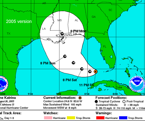
However, with the advances in technology, the National Hurricane Center has improved their prediction forecast…aka technology has improved to showcase the areas likely to be hit.

Regardless of your location, please prepare for hurricanes.
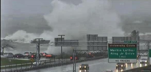
Yes, three years ago, I was told “…that will never happen here” and “Stop wasting your time.” Soon after, Hurricane Sandy hit Ohio in 2012.
Know where to go. If you are ordered to evacuate, know the local hurricane evacuation route(s) to take and have a plan for where you can stay. Contact your local emergency management agency for more information.
No matter where you are, please prepare for hurricanes.
Don’t wait. Communicate. Make your emergency plan today.
No one wants to be unprepared.
Peeking into the third week of National Preparedness Month – this week is all about Hurricanes!
So to make sure we are all prepared, I double checked my weather radio yesterday.
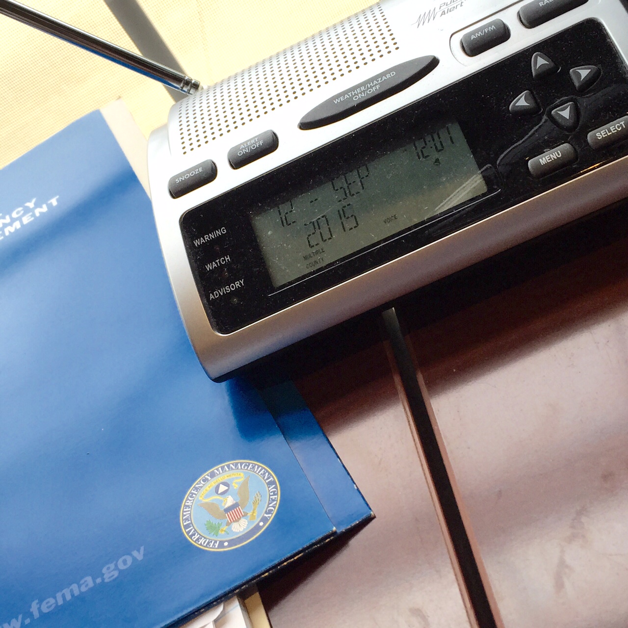
I’m Ready!
If you live in Ohio, don’t forget to program your weather radio with these specific frequencies.
Don’t wait. Communicate. Make your emergency plan today.
Third week in. Are you Ready?
Awwww yeah! This past week, I got a chance to teach part of the brand new DHS/FEMA G0290: Basic Public Information Officer Course!

Formerly known as G-290 course, this is the new FEMA Basic Public Information Officer course taught across the country for all public safety and emergency management professionals.
Thanks again to the Kentucky Emergency Management Agency and KESC for allowing me the opportunity. Also, special thanks to the ever fashionable Mike from NIOA.

Shakas because we are reporting live from Kentucky…
It was great to spend some time with Ohio EMA leadership yesterday.

Discussion on community resilience, task force deployments, Presidential Declarations, key initiatives, outreach, training, EMAC deployments, stakeholder engagement, public information officer, Emergency Management visibility, social media, Public Assistance, SBA loans, documentation and reimbursements, FEMA Administrator Craig Fugate, Public and Private partnerships…heck-we even touched on the buzz words for 2015: Climate change and Cyber.
For sure, lots of notes!
It is so great to hear OEMA Executive Director Sima Merick passionate about all facets of Emergency Management.

Also got a chance to hang with my Ohio EMA Training and Education peeps Lisa and Susan too. Solid discussion about the upcoming Mass Fatalities course (G-386), PIO Courses (G-290), JIC/JIS Courses (G-291), Intermediate Incident Command courses (ICS-300), and the Recovery from Disasters Course (G-270.4).
Lots of good free stuff upcoming from Ohio EMA!
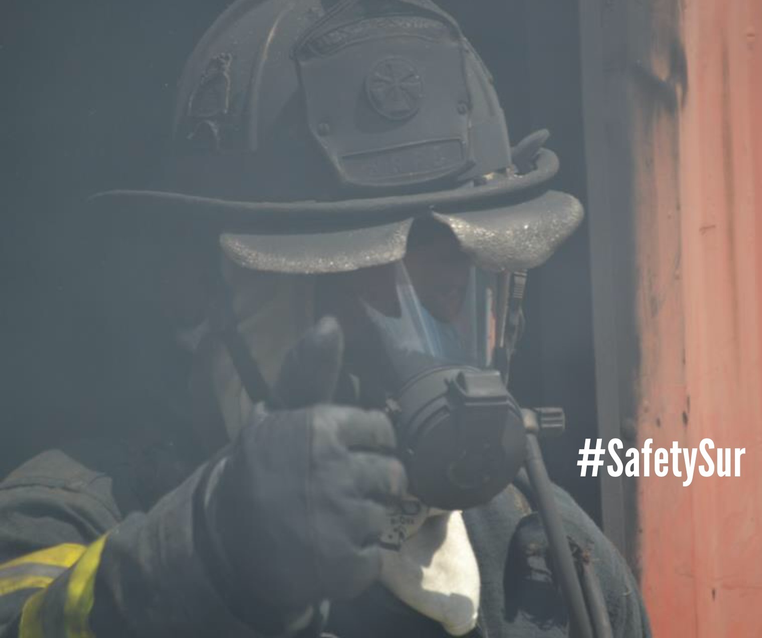
BTW-If you did a double take on that first picture, yes sir Sur, #AlohaFridays are made for an Aloha shirt. Period. Also a historical note, Hawaii became the 50th state on August 21, 1959.
Don’t worry peeps, look closely as I had my Ohio pin on.
Have a great weekend!
I popped back-to-back-to-back social media classes last week in Sacramento, California.

Participants from all over the west coast attended. Specifically for Thursday and Friday, FEMA reviewed our new curriculum courses. Yep, straight up evaluation. Not going to lie, I was pretty nervous.

Ongoing for course design, I will make a few more additions/changes before courses are sent to the National Training and Exercise Division (NTED) for certification. Hoping for final approval in November 2015. Hope to hear the magical words “Federally published” as my course is listed in the DHS / FEMA Training catalog. Whoa Nellie!

For the classes? We had great interaction from all participants.

Solid discussions during the breakout sessions included professionals from all Emergency Support Functions (ESFs) as well as experts from the National Weather Service (NWS), Critical Infrastructure, and Volunteer Organizations Active in Disasters (VOADs), etc… Diverse groups make for the best discussions for sure!

As part of our continued efforts in Emergency Management, it is imperative that we address issues from the All-Hazards approach and incorporate the support of our stakeholders in solutions.
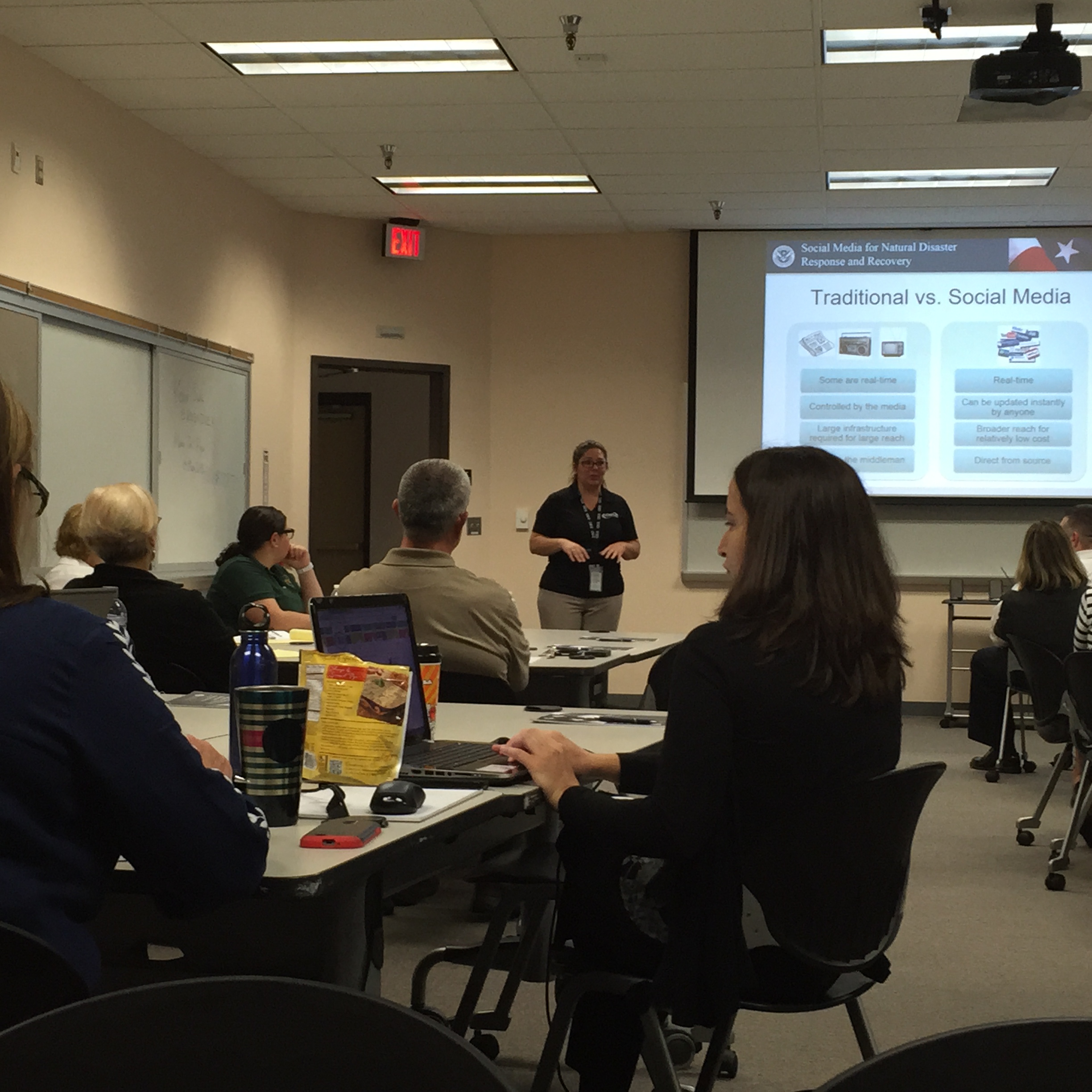
With heavy discussion, class participants had a great time engaging with others and using tools/techniques that are specific to the Preparedness, Response, Recovery, and Mitigation Directorates. Obviously, I showcased the importance of a good Public Information Officer (PIO) / Public Affairs Officer (PAO) and how their interaction in the Emergency Operation Center (EOC) or the Joint Information Center/System (JIC/JIS) is imperative to a successful emergency or disaster.
Also, starting to build an online learning library that can be easily accessed from anywhere using the #NDPTC is always good reference. Free. My favorite F-word.

Special mahalos to fellow Instructors Cheryl and MaryJo in the delivery of these courses.

Also the solid smiles from fellow #SMEM Jennifer and Scott was crucial support on this delivery.
Glad to be working with partners like the Department of Homeland Security (DHS), Federal Emergency Management Agency (FEMA), National Domestic Preparedness Consortium (NDPC), and the National Disaster Preparedness Training Center (NDPTC). Truly great to see everyone working collaboratively. Thanks to the Sacramento County Emergency Management for hosting these courses.
Looking forward to the next class at the International Association of Emergency Managers (IAEM) conference in Clark County, Nevada. See you there!
My friends at @FEMA –
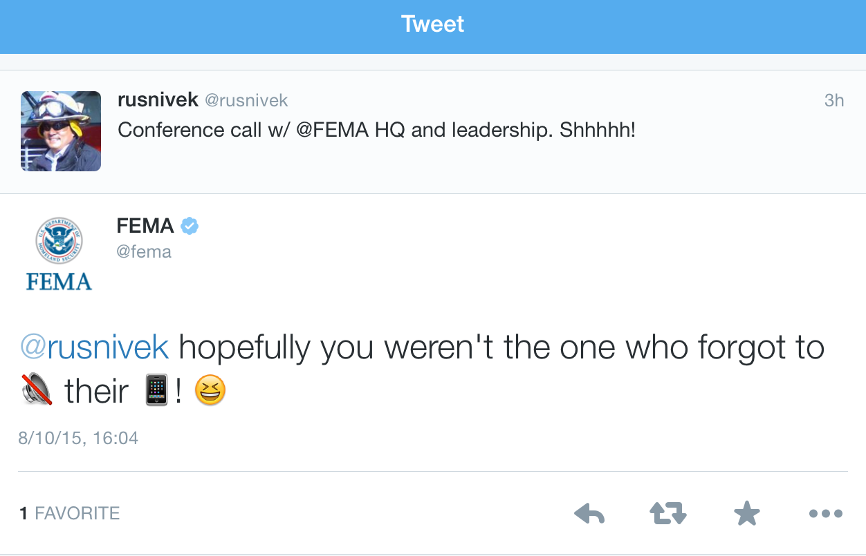
See, government DOES have a sense of humor.
Bonus points for the fed emoticons in the twitter reply too. #Nooice
